172.8 million
images captured daily by VIIRS
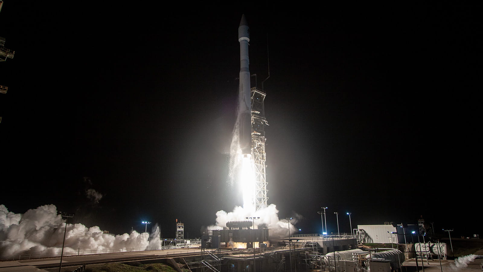
The Atlas V soars into space Nov. 10, 2022. JPSS-2 released from the Atlas rocket 28 minutes after launch. (Credit: United Launch Alliance)
It’s 1:42 a.m., and everyone is staring at the sky.
In a dimly lit field near Vandenberg Space Force Base in Lompoc, California, a small crowd has gathered on this chilly morning. A voice booms from the loudspeakers: “All systems go!”
That voice belongs to a NASA announcer, and he has news for the crowd at the base’s “Hawk’s Nest” viewing site: We’re seven minutes from liftoff for the Joint Polar Satellite System 2.
The crowd cheers and claps. For them, it’s more than a launch. It’s one of the biggest moments of their lives – the culmination of years spent designing, building and testing one of the world’s most advanced sensors. Now, that sensor is going into space.
“You have those times where it’s like, I remember what that person was wearing, what they were saying, what it smelled like…it’s a moment that will never leave you,” said Matt Magaña, vice president of Space Systems at Raytheon.
Seven minutes later, the voice returns: “T-10, 9, 8, 7….” The volume swells as the crowd, pressed tightly against a metal fence trying to inch themselves closer to the best possible viewing spot, joins in the countdown chant.
“Ignition…and liftoff!”
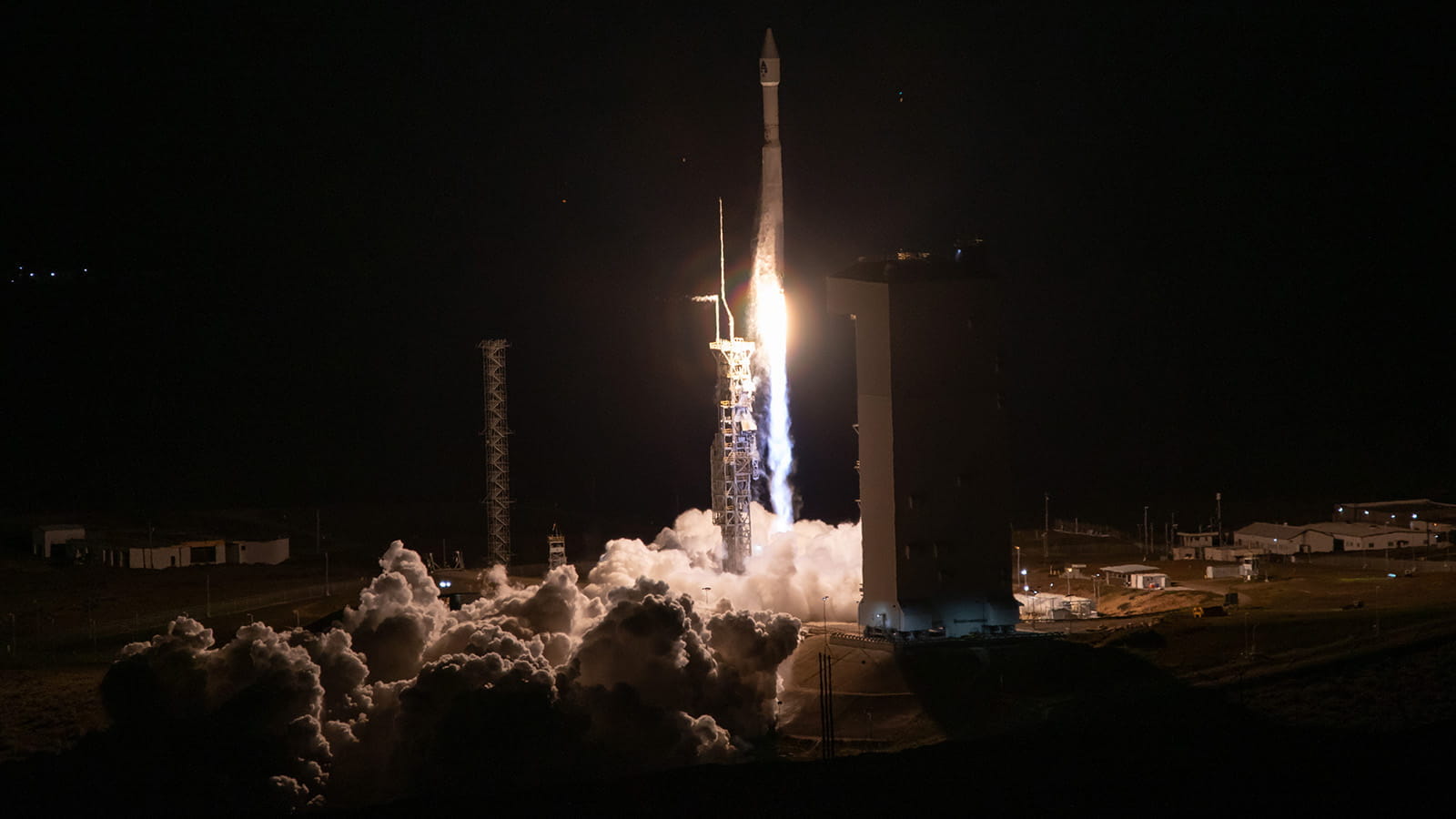
Just about 10 minutes before 2 a.m. on Nov. 10, 2022, an Atlas V 401 rocket launches, lighting up the sky. The crowd at the Hawk’s Nest is seven and a half miles away, but they can still hear the rocket roar.
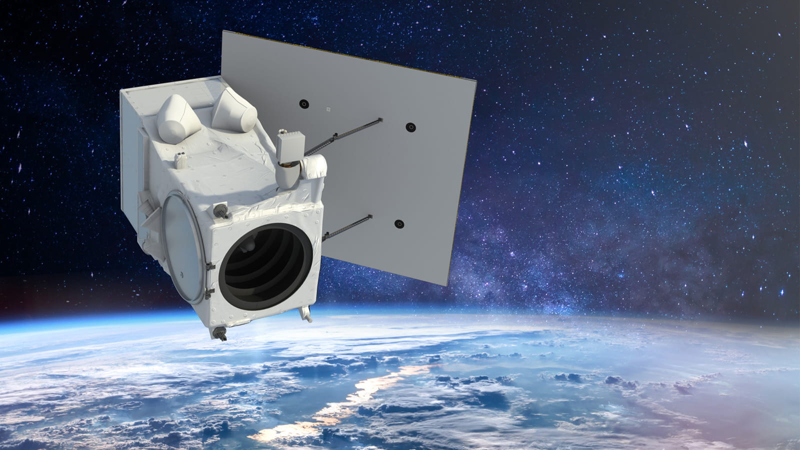
The launch of JPSS-2, a collaboration among the National Oceanic and Atmospheric Administration, NASA and industry partners, will advance weather forecasts, provide earlier extreme weather warnings and monitor changes in our climate. Key to the mission is the Visible Infrared Imaging Radiometer Suite, or VIIRS, which was developed and manufactured by Raytheon.
VIIRS is a satellite instrument that captures photons, or particles of light, then uses them to produce images of Earth just as a camera would. Researchers then process them for environmental data records, which help weather scientists detect hurricanes, monitor forest fires, assess vegetation health, discern ocean color patterns and measure changes in our climate over time.
While JPSS-2 is new, the program, including VIIRS, has been helping scientists monitor Earth for more than a decade. The program began in the early 2000s. VIIRS became operational in 2011 when it launched on the Suomi NPP mission, and it was launched again in 2017 as part of the JPSS-1 mission, now called NOAA-20. JPSS-2 joins Suomi NPP and NOAA-20 in orbiting Earth from 500 miles away, photographing the entire globe twice a day.
Adding a third source of data on orbit provides greater accuracy in weather forecasting and in monitoring changes to rapidly evolving weather events like hurricanes, said Edmond Chung, JPSS VIIRS program manager.
“It’s about continuity,” Chung said. “Having multiple sensors instead of one lets us collect more data to get more accurate weather forecasting.”
In preparing for JPSS-2, VIIRS saw its share of design and performance updates, too. To prevent unwanted light from entering through a path other than its telescope, a type of shield called a Straylight Baffle was incorporated into the design to improve performance on orbit. The focal planes – the distance between the camera lens and the perfect point of focus in an image – were tuned to increase accuracy and sensitivity in their wavelength ranges and to collect a higher volume of photons for sharper, clearer images.
images captured daily by VIIRS
speed of JPSS satellites
weight of VIIRS
orbits of the Earth daily by JPSS satellites
VIIRS’ capabilities extend beyond daily mobile weather forecasts. Its extreme weather warnings save lives. Julie Montoya, VIIRS’ lead systems engineer, knows all about that.
Her former college roommate had just moved to Santa Barbara in 2018 as wildfires were ravaging much of California. She needed accurate information to make her evacuation plans, but frantic news coverage made it hard to tell fact from fear. VIIRS data gave her the clarity she needed.
“There was a fire map with VIIRS data on NOAA’s website that showed where the fires were, color coding areas in red that needed to be evacuated,” Montoya said. “She came to stay with us for the nights she had to evacuate. It’s nice to know I personally helped someone.”
Another sensor on VIIRS, the day-night band camera, can take pictures in both very high and low light conditions, in rapid succession. That results in images of Earth's terminator – the line that shows the difference between dark and light – every 1.6 seconds.
The images it produces reveal light densities, and those are useful for several reasons. They can, for example, show emergency crews where to restore power after hurricanes. They can also detect patterns of human activity at night, like the squid fishing boats often seen off the coast of Japan.
They've even been used to estimate a country's gross domestic product, as places with higher light densities tend to have more industry and greater technological advancement.
Testing that camera was no small feat. The team recalls a testing process of late nights, takeout meals and being quite literally in the dark.
“The day-night band was so difficult to test, it was like creating a mini-sensor in itself,” Chung said. “It took six months to test the first focal plane assembly. And since it’s so sensitive to light, we had to test entirely in the dark.”
Several months, iterations and design updates later, the team experienced the day-night band’s first real-world results when VIIRS launched on Suomi NPP. Not only did the results impress, they put the company on the map in regard to low-light imagery.
“Seeing the first data products that came out of the day-night band, that was one of the proudest moments of my life,” Chung said. “There isn’t a weather satellite that allows our customers to monitor weather like Raytheon does at night.”
The United Launch Alliance Atlas V rocket, carrying the JPSS-2 satellite, lifts off from Vandenberg Space Force Base, California, Nov. 10, 2022, at 4:49 a.m. Eastern Time. (Credit: United Launch Alliance)
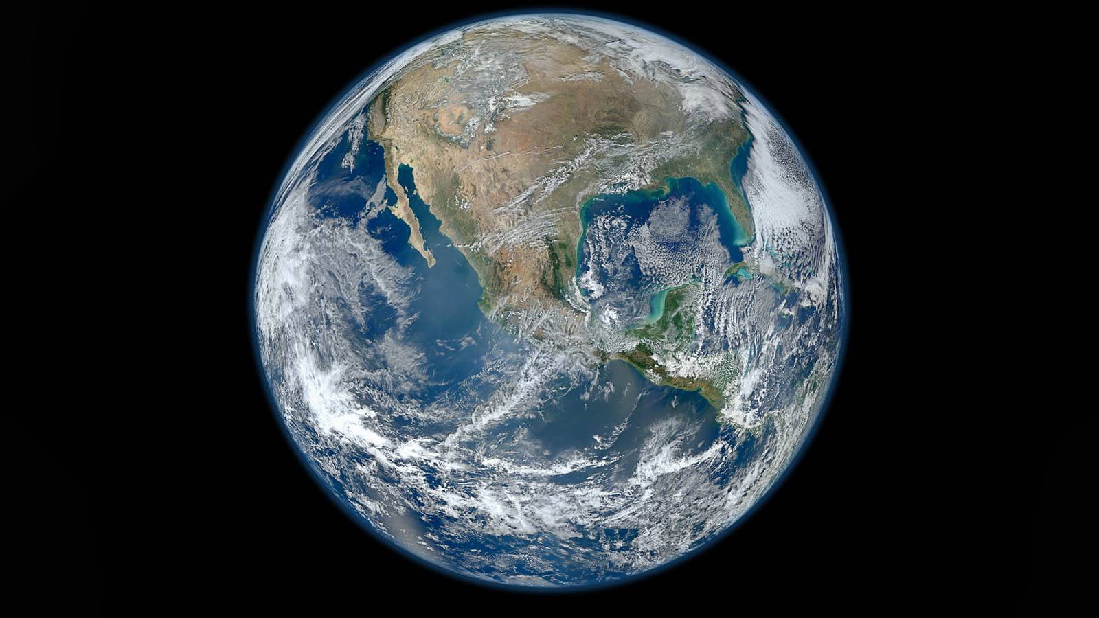
The Big Blue Marble is one of the first composites of the entire Earth to come from the Suomi NPP mission. Taken on Jan. 4, 2012, this is perhaps the day-night band’s most iconic image. (Credit: NASA)
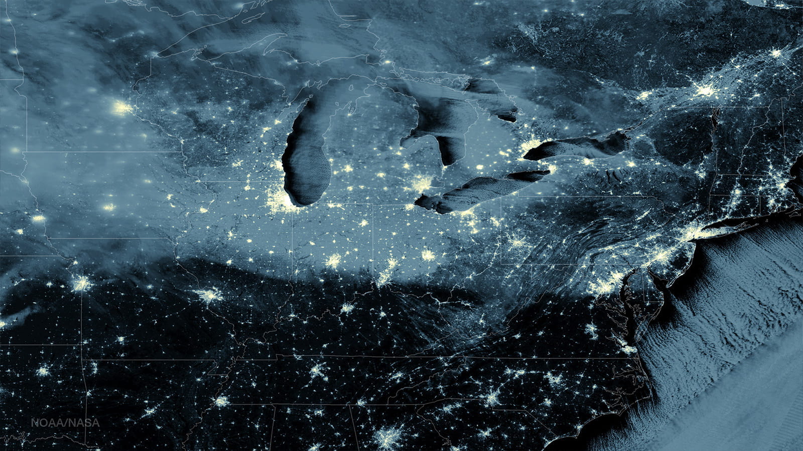
VIIRS’ Day/Night Band captures early morning snowfall across the eastern United States in January 2015. (Credit: NOAA)
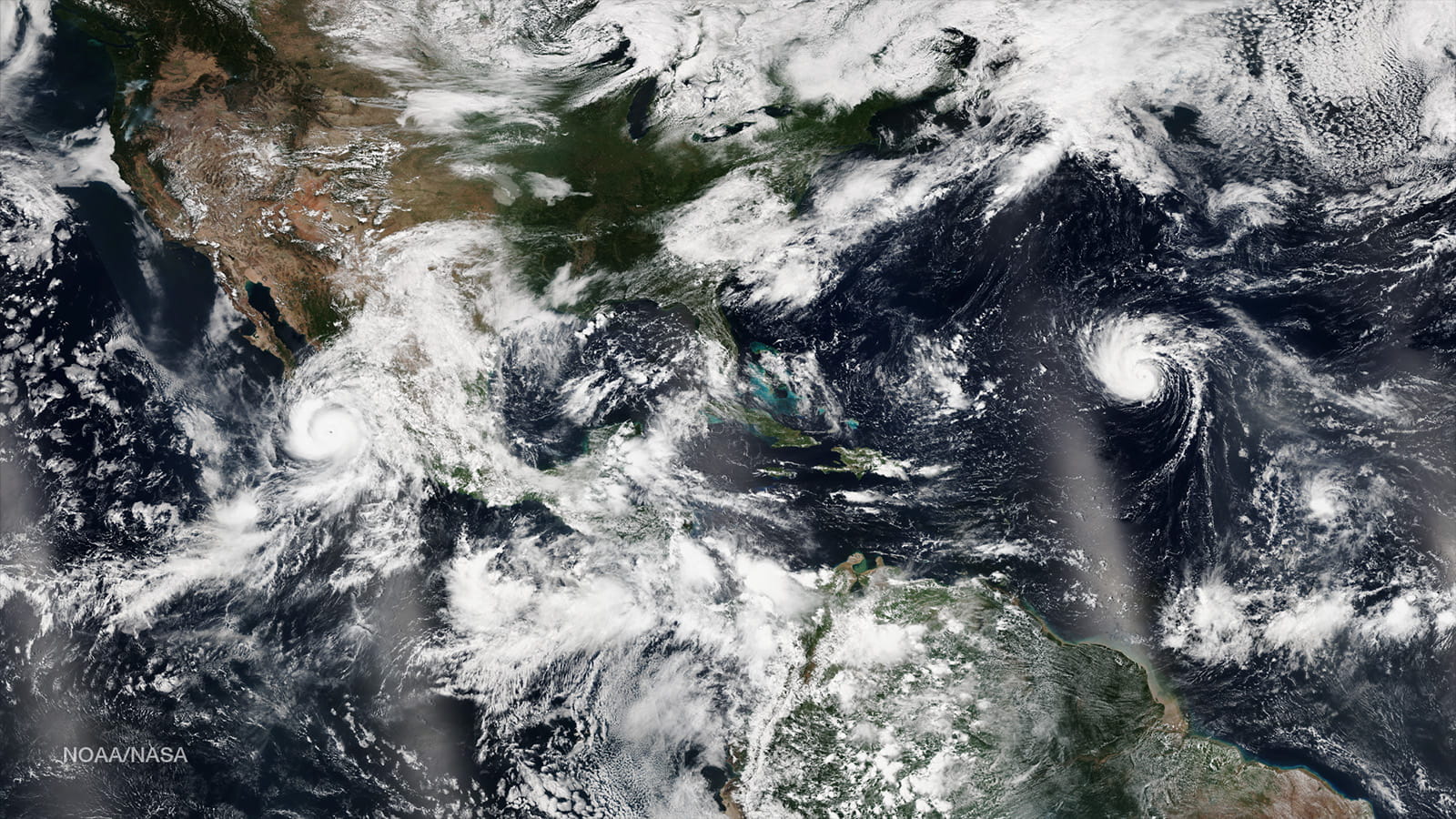
VIIRS captures Hurricane Odile in the Pacific Ocean and Hurricane Edouard in the Atlantic in September 2014. (Credit: NOAA)
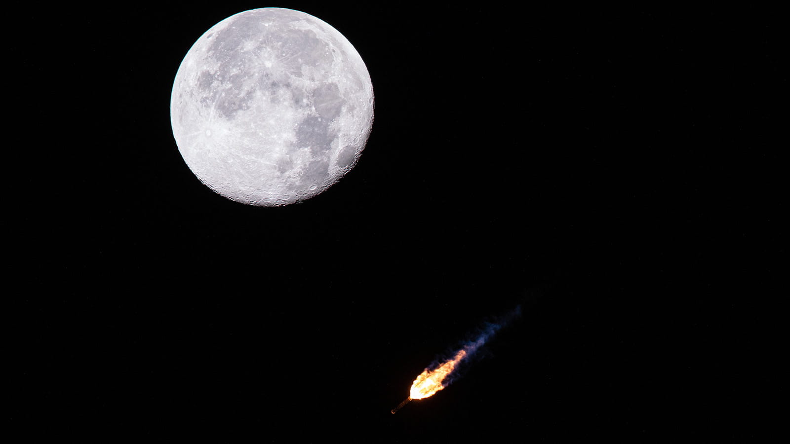
The Atlas V soars into space Nov. 10, 2022. JPSS-2 released from the Atlas rocket 28 minutes after launch. (Credit: United Launch Alliance)
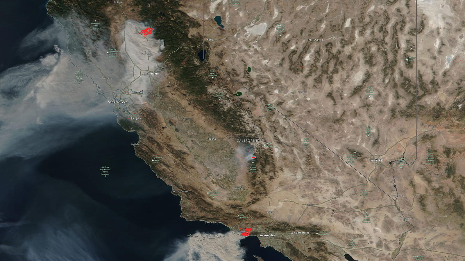
VIIRS locates California wildfires in November 2018, helping inform residents if and when to evacuate. (Credit: NASA)
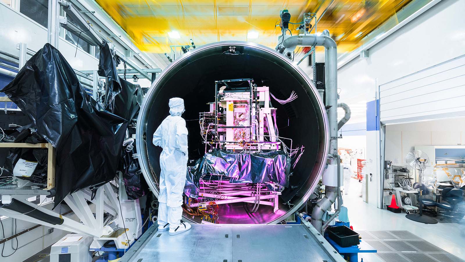
VIIRS undergoes a thermal vacuum chamber test in El Segundo, California. (Credit: Reuben Wu)
The VIIRS program has gone over well. Customers have rated it highly on assessments, and the team has learned how to minimize its cost and stay on schedule through years of working with the hardware and navigating the testing and build process.
“Having this program that started so long ago and having those lessons learned really help us to execute,” said Liana Yee, VIIRS deputy program manager. “The customer recognizes what we do and how we work with them to make sure the impact to the program is minimal.”
The team has finished the next rendition of VIIRS for the JPSS-3 mission and will deliver it to NASA on behalf of NOAA in February 2023. They are currently building and testing it for JPSS-4, with JPSS missions scheduled to run until 2036.
What lies beyond JPSS? Montoya said VIIRS’ outstanding track record, paired with new advancements in technology, could lead to a “very cool” redesign.
“If we could build VIIRS with a new design that uses advancements in technology over the recent years,” she said, “I think we could do something really special.”
For Chung, who has devoted half his career to the VIIRS program, watching his life’s work ascend into orbit was especially meaningful. Huddled under a blanket at the Hawk’s Nest with his wife and two young daughters, he realized he’ll always be a part of the mission – even when the JPSS-2 satellite is hundreds of miles away.
“It’s a proud moment,” he said. “A piece of you is going into space.”