
Advanced Weather Interactive Processing System
The Advanced Weather Interactive Processing System, or AWIPS, is the National Oceanic and Atmospheric Administration/National Weather Service's (NOAA/NWS) weather forecasting data and display toolkit. AWIPS ingests and analyzes data, creates useful visualizations and distributes time-sensitive weather statements such as watches and warnings. Since 2005, Raytheon has been a trusted partner in the AWIPS weather enterprise, providing low-risk operations, maintenance and continuous innovation.
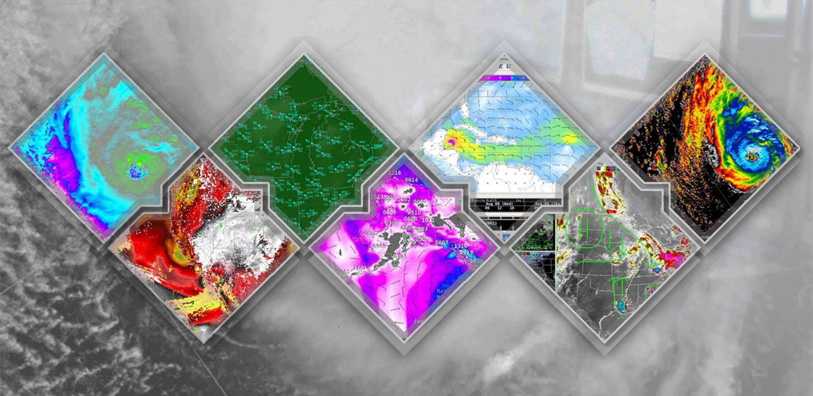
AWIPS enables forecasters to make weather predictions that can ultimately save lives. It's a complex network of systems that ingest and integrate meteorological, hydrological, satellite and radar data. Forecasters at more than 130 NWS offices across the nation use the capabilities of AWIPS to make increasingly accurate weather predictions and to dispense rapid, highly reliable warnings and advisories.
RTX delivers key weather capabilities
In September 2015, Raytheon delivered AWIPS II, the next-generation upgrade to the AWIPS system. The AWIPS update includes powerful new capabilities that help meteorologists deliver more precise forecasts sooner. As the architect of the AWIPS evolution, Raytheon designed, developed and deployed the system's next-generation hardware and software. AWIPS now supports forecasters in the field and responding on location to weather emergencies. It now features simplified code and system performance coupled with a reduced maintenance burden. All of this has been achieved while retaining a system look and feel that makes the AWIPS evolution appear familiar to the user.
Updated AWIPS Capabilities Include:
- Scalable from laptops to servers, enabling forecasters to work on location with emergency responders
- Data from all kinds of sources, such as weather radars and environmental satellites orbiting in space
- Highest resolution available from each sensor – enabling precision forecasts
- Open-source software enables low-cost maintenance, stability, and most importantly, continuous improvement to forecast accuracy and timeliness
- A variety of data types are processed in real time, allowing video game-like visualizations and interaction
- Maps display and re-project nearly instantaneously, with seamless scrolling and zooming
- Automated text generation allows weather statements — such as watches and warnings — to be issued rapidly to help protect lives and safeguard property
Our vision for AWIPS is based on an unwavering commitment to the NOAA/NWS mission. The Raytheon team thrives on a shared belief that operating in partnership with our customer, accepting responsibility for the system entrusted to us and pursuing innovation wherever it adds value will yield benefits for AWIPS users and the public. We execute the AWIPS mission through the creation of a working environment that enables our team to consistently turn requirements into high-quality, highly responsive, cost-effective solutions.
Key Features and Benefits
- Raytheon manages the operations, maintenance and evolution of AWIPS, leading an experienced, reliable team of large and small businesses that support NOAA/NWS' initiatives and strategic efforts.
- Raytheon's Service Level Management Process defines a life cycle of continuous improvement grounded in open communication. It ensures that we respond quickly to changes in NOAA/NWS' scientific, technology and business goals for AWIPS.
- We provide hardware, software and communications services to the entire AWIPS network, including NWS Weather Forecast Offices, River Forecast Centers, regional headquarters and Environmental Prediction Centers dispersed across the U. S. and its territories.