110,000
miles of rivers currently mapped under the project
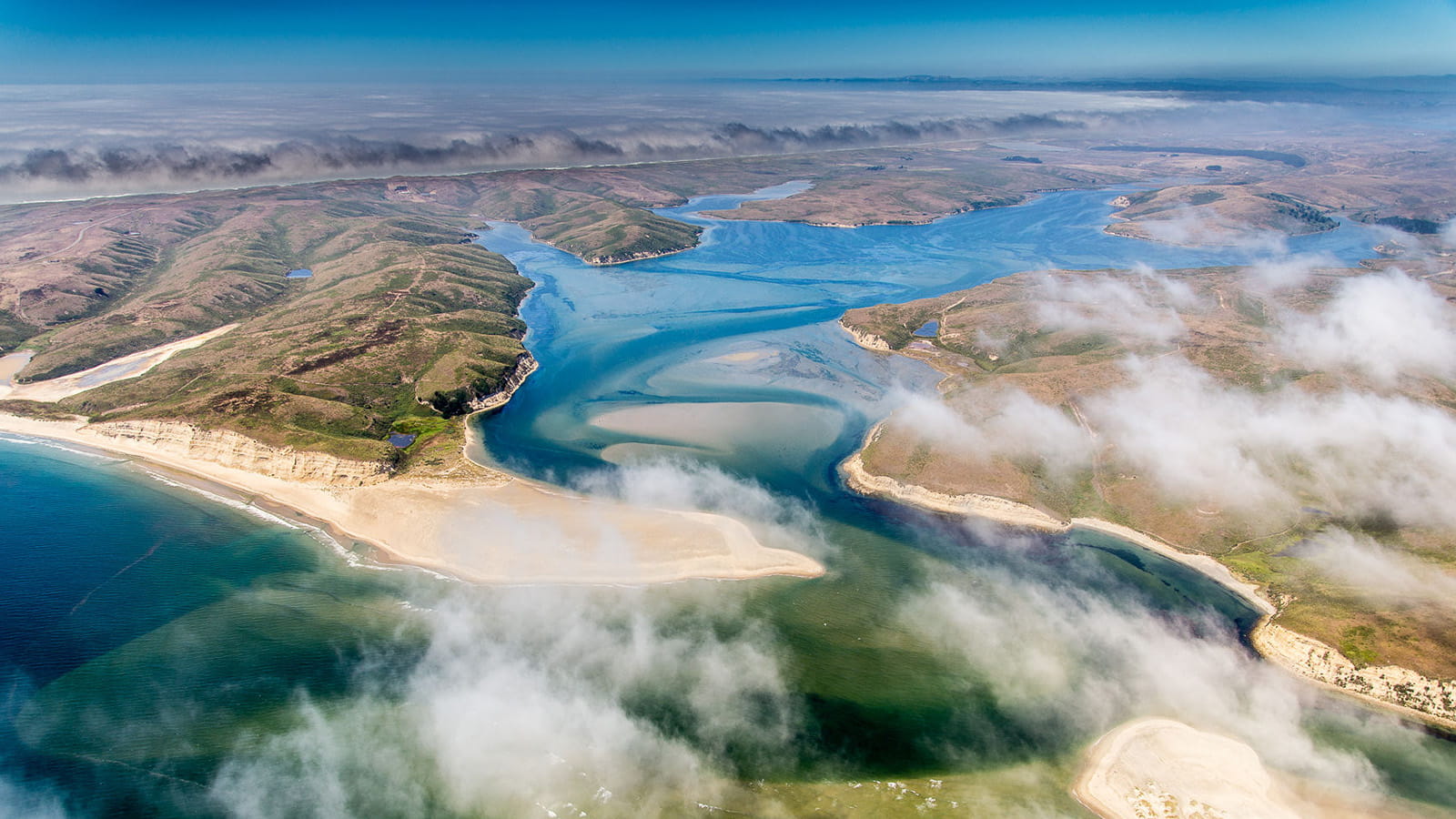
An aerial view of Drakes Bay in California. U.S. coastal areas, rivers, lakes and streams are the focus of a new project Raytheon has taken on to help the National Oceanic Atmospheric Administration improve its ability to predict the effects of weather on waterways. Photo Credit: NOAA/Brian Cluer
Living in a landlocked state made Shawn Miller appreciate water.
Near his home in metro Denver, Miller has access to modest lakes and streams. Larger bodies of water, like the Colorado, Rio Grande and Arkansas rivers that provide the region with vital resources, are a little farther away.
Understanding the effects of severe weather on those rivers has become critical, he said.
“There’s constant competition for that water in neighboring states,” he said, adding that severe weather has made the resource less predictable. “Certain events are happening more often, like floods and droughts, that are related to water and how it moves around the terrain.”
That reality now informs Miller’s work as part of a Raytheon team helping the U.S. federal government in its quest to transform the science of water resources forecasting. One method: through new, data-driven maps that will show the effects of weather on every waterway in the United States, both as a forecast and in real time.
The project has two main aims: to better prepare first responders and others for severe weather and its effects on water levels, and to improve water management through more accurate long-range forecasts that show water availability.
Raytheon, an RTX business, has been awarded a contract from the National Oceanic and Atmospheric Administration to enhance the U.S.’ water resources prediction capabilities. Doing so, NOAA believes, could significantly improve emergency alerts, save lives and mitigate the economic impact of major storms.
Under the four-year, $80 million task order, Raytheon will work closely with the National Weather Service to transform and innovate key parts of the NWS’ prototype Next Generation Water Model Framework, a cloud environment that will allow NOAA scientists to rapidly access and analyze data.
Raytheon is focused on the engineering aspect of the framework, enhancing the tools available to the water resources enterprise and NOAA, and making them work together.
The work builds on a nearly 20-year business relationship between Raytheon and NOAA. That history has included the Advanced Weather Interactive Processing System enterprise, or AWIPS, a weather forecasting data and display toolkit, and the Earth Prediction Innovation Center, or EPIC, a widely accessible and user-friendly Earth modeling system.
Raytheon is working with NOAA to develop and optimize the U.S.’ ability to predict the effects of severe weather on water resources.
miles of rivers currently mapped under the project
miles of rivers in the United States
Under the new contract, Raytheon will provide critical capabilities that support weather, water and climate enterprise – the three main sectors of NOAA and NWS that contribute to the science and application of weather and weather forecasting.
“It’s about increasing the forecast skill for the National Water Model,” said Shevy Greene, a program manager for Next Generation Water Prediction Capability at Raytheon. “A lot of these model formulations are done regionally.”
As of October 2023, 10% of the U.S. population was served by the NWS’ expanded Flood Inundation Mapping services. The completed initiative will serve every community nationwide, with enhanced river forecasts for 3.4 million miles of waterways – forecasts that will reflect the nuances of how specific types and amounts of precipitation play out locally.
“Flooding tends to occur in specific concentrated areas rather than spreading uniformly across different regions,” Greene said.
The scale of the project is one challenge. An even bigger task will be to render the maps in higher resolution, which will yield more accurate data for forecasters and scientists and, in turn, lead to better planning and emergency response.
“This is a bit more complex than what’s currently available,” Miller said. “It’s challenging.”
Raytheon is responsible for developing and testing the migration of data to the cloud that will enable NOAA to better address the needs of communities nationwide, facilitating decision-making before and during water-related events ranging from floods to drought.
“It really boils down to giving people more actionable and reliable information faster,” Miller said. “Better information leads to better decisions.”